


“VR is unique in creating this sense of presence like you're right there with another person or in another place. If you can't think of any way that your reality can't be better, then you're not thinking hard enough. It's not about escaping reality, it's about making it better.”
Marc Zuckerberg

Immersive technologies, or virtual reality, mixed reality and 360 video, are increasingly being used in everyday life due to the rapid development of software and modern computers. Today, even people with little to no knowledge of how various gadgets work can enjoy achievements of the great tech race, such as exploring the streets anywhere in the world, using Google Street View, or catching Pokemon using Pokemon GO, or watching exciting news reports through the New York Times app called NYT VR.
Virtual reality is now a popular tool in the field of urban planning and the development of city master plans. In this case, the virtual reality (VR) system is a dynamic layout of the city. The active participation of experts from various fields (construction, communications, utilities, transport, demography, ecology, etc.), city officials and citizens in such a dynamic layout allow them to create high quality, optimized strategic plans for living space of individual projects, areas, and entire cities.

For example, a few years ago in San Francisco, city planners used passers-by to participate in the “OWL Eyes” virtual reality program project to determine the best design option for Market Street. In San Jose, landscape architects helped stakeholders present different options for developing a new urban neighbourhood of government agencies using the Scope app for the iPhone. In Washington, DC, virtual reality tools were used to create pedestrian crossings, and in Singapore and Riyadh, mixed reality tools allowed people to see what their cities would look like in the future.
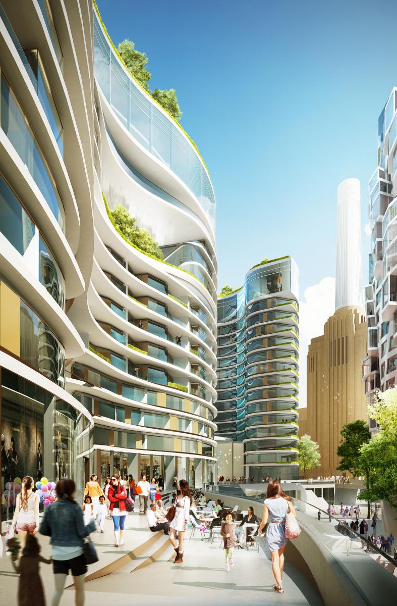
Reality immersion technologies help professionals in urban planning and development, in developing the best design solutions possible, being limited only by imagination and physics. Developers can view the projects under construction in more detail, more accurately assess the existing conditions. New technologies allow the use of a wide range of tools to test assumptions and identify possible problems at the earliest stages of design. Even during construction, immersion technologies can provide better quality control. Using mixed reality, designers can superimpose their three-dimensional design models on top of what is being built on-site, making it easier to eliminate design errors at the earliest stages of project development. An environment created by technology and immersion in reality often makes a very strong impression on viewers not only visually but also technologically, and this helps designers to present their ideas to the general public in the most spectacular way. Images can be more realistic than a typical flat visualization and completely capture the attention of viewers who become explorers of a new space or object.

The very term “virtual space” and "immersion environment" is applied to several new technologies with similar perceptual qualities. They differ in the type of virtual space and how freely one can move in this space. Here are just a few examples of such environments:
Spherical panoramas use a series of connected spherical images that the user can move around, creating the illusion of real space. An example of such an environment is Google Street View. To "immerse" in this technology, the user needs special glasses, a mouse or a touch screen for a panoramic spherical image on a desktop or tablet.
Virtual Reality (VR) — it is a modelled and textured space. To experience VR, the user needs to put on a special headset to move freely through the virtual space. Glance, gesture, or voice input, which are sometimes options in VR applications, allow the user to navigate, interact with the environment, or select menu options.
Mixed reality (MR) overlays digital 3D models or animations on existing, real-world environments. For example, Snapchat filters. To experience MR, you need to use your smartphone or tablet, held at arm's length, to apply a model or animation to your face, for example.
360 videos use camcorders to capture a sphere, record real-world locations and events, and provide an FPV (first-person view) during playback. The impressive videos of RYOT, a video production company dedicated to journalism, exemplify 360 video technology. Videos are viewed with a headset and they move when the user moves their head; the desktop uses a mouse or touch screen for panoramic spherical video.
Augmented reality (AR) — an environment perceived by the human senses, in which visual, auditory, tactile, gustatory, or olfactory information from physical objects and phenomena is supplemented by digital data generated by a computer in real-time attached to them. Most often, augmented reality is understood as an environment in which computer graphics are superimposed on physical objects in the field of view of a person in the form of two-dimensional and three-dimensional models, the selection of objects in any graphic way or alphanumeric signatures. Augmented reality is perceived using technical means such as smartphones, smart glasses, helmets, headphones, projection systems.
Modern technology and urban planning

The global pace of urbanization is fueling rapid urban development, and population growth is a major challenge today. The influx of people to the cities is fueling demand for basic services such as water, energy, transport, waste management, education, health care, safety and housing. At the same time, climate change is forcing cities to follow the principles of sustainable development and minimize environmental impact. Therefore, in the face of an eternal struggle with time constraints and limited resources, city planners must identify the most important projects and ensure their priority development so that available funds best meet the needs of citizens. Virtual reality can revolutionize urban planning by supporting cities in making optimal decisions. The most common areas of using virtual reality in modern cities come down to tracking accidents in water supply, gas supply, power grids, and the corresponding movement of engineering teams, police, ambulance, emergency services; maintenance of engineering systems with graphic instructions superimposed on them; planning of engineering infrastructure on a map displayed directly on the ground/building; a comprehensive understanding of processes and interdependencies through the display of the entire Internet of Things on a single interactive three-dimensional map; integration of the active population into the system of urban economy, etc.
Within the framework of individual projects, the use of VR allows city planners to demonstrate and control the process of project implementation, as well as visualize plans for future developments. Most importantly, VR can make complex engineering and architectural designs more understandable and user-friendly - using VR presentations to visualize future projects allows the general public, citizens, and city officials to see such plans through the same lens, making urban planning more accessible for citizens. By gaining a better understanding of the project, people can reflect on its impact on their lives and their city and provide valuable feedback.
Here are just some of the most successful examples of the use of virtual reality in real-world practice.

The redevelopment project of one of the streets of San Francisco - The Better Market Street. The City Planning Department wanted feedback on plans to redesign the city street. As part of the project, a virtual environment was created around Market Street with several options for changing its design. Dedicated software imported the data to create 3D digital models. Then two spherical panoramas with different design options were exported, the images were uploaded to an iPad and installed in the OWL prototype. A telescope-like OWL was installed on Market Street within a week. This allowed residents, office workers and simply caring passers-by to look into the device, see options for changing the street design and share their opinions. Thus, the urban development planning department was able to receive direct feedback and choose the most optimal option for the development of a city street, taking into account all the wishes of stakeholders.

A project to determine the best natural lighting for a workplace at NVIDIA's new Santa Clara, California office. The office area is 550,000 sq. feet. The VR project involved architects, builders, and company representatives, allowing the project team to integrate VR-based visualization into the design process. Iterative daylight simulation involved overlaying up to 5000 lights per image. Using technology and cluster computing to combine GPU power, developers were able to generate an image in just ten minutes, turning the technology into a rapidly deployable design tool. The resulting "simulations" guided the design of workplaces in the new office, where NVIDIA sought to maximize the quality and quantity of natural light. As a result, simulations showed that not as many skylights on the roof and sidewalls of the building were required to achieve correct lighting as originally intended.

The San Francisco Presidio Parkway project aimed to redevelop an ageing 1.6-mile portion of the city's transportation route. Originally built in 1936, the highway did not meet modern standards, was not seismically stable enough and had to be transformed into a modern and safe 6-lane highway. The project team had to comprehensively tackle several major challenges to replace the existing infrastructure, maintain traffic during construction, preserve the adjacent national park, ensure public participation in the project, and coordinate a large group of stakeholders. The simple idea that brought everyone together was to create not a highway, but a boulevard, something that would help improve the experience of every road user. Using virtual reality tools, in particular Autodesk BIM, the team was able to create the project before it was built in the real world. In particular, Civil 3D software was used to create a virtual model of the infrastructure and Navisworks - construction planning software, as well as 3ds Max Design - software for model-based design visualizations. This allowed the project team to analyze development alternatives at an early stage, evaluate construction plans, and more clearly present project proposals to the public and stakeholders, helping to speed up the approval process and mitigate public concerns.

Owlized developed a virtual reality project for Santa Monica, California last fall to engage residents and visitors alike about the potential impact of rising sea levels. Viewfinders positioned at Santa Monica Pier have shown how waves amplified by a sea-level rise from global warming can affect the beach, as well as possible solutions to the problem, such as erecting protective dunes. It is difficult for people to imagine the impact of climate change because it seems that all this will not happen very soon. Virtual reality tools help people better visualize the possible future more realistically. This, in turn, helps to better inform the public about the possible impacts of climate change.

In the Katara Cultural Village project, virtual reality facilitated dialogue between various stakeholders to make decisions about the future development of the project with active public participation. Through the use of VR tools, a realistic display of current and proposed construction plans for the Ethnographic Village at MIPIM was created. Through the VR model, exhibition visitors, residents and officials could wander inside the complex, which would be impossible in real life, and get a unique view of the proposed changes. The challenge was how to properly convey the size and scope of a large village development project. Traditional models and animation do not provide an opportunity to take into account the full-scale nature of these changes and their impact on the development of the project, and also do not allow the viewer to actively participate in the process, but only to observe how it will look. EON Icube Mobile tools were used to display a realistic model of Qatar's ethnographic village, highlighting the main components of the existing site as well as planned future additions. This allowed the project participants to get a realistic view of the construction and “walk” through the village as if they were there. The initial data for the project consisted of more than 250 gigabytes of information and was processed and optimized in the software for creating virtual reality - EON Reality.
The London Boulevard project in London was created to transform the chaotic cycling route connecting Old Street and Oxford Street into a “healthy route” under the TfL Healthy Streets program. The existing bike route (the London Boulevard), a 1.9-mile stretch of road from Old Street to Tottenham Court Road through Clerkenwell Road and Theobalds Road, which had up to 1,152 cyclists during morning rush hours, also lacked any protective infrastructure. outside the painted lanes. This is a very popular and highly congested London route used by cyclists - at rush hour the number of cyclists is 2.5 times the number of all other vehicles combined, which forces numerous pedestrians to dodge bicycles and cars along this route, so the challenge of the project was to show alternatives that are more convenient and “peaceful”, corresponding to the concept of “healthy street” (including the creation and expansion of sidewalks, the allocation of pedestrian zones, the separation of bike paths with protective barriers, landscaping, etc.). As a result of The London Boulevard, the route needed to be redesigned to be safer for pedestrians and cyclists and to reduce car traffic by developing more efficient road transport.

The Healthy Streets Program puts people and their health at the heart of decision-making in urban development and governance. This is leading to a healthier city where people choose to walk, cycle or use public transport as an alternative to using private cars.
The Healthy Streets Program is a long-term plan to improve the lives of Londoners and city visitors on the streets, helping everyone to be more active and enjoy health benefits. 80% of Londoners visit the city streets every day. The best way to get more people to go hiking, cycling, or using public transportation is to improve the city street experience. The Healthy Streets program focuses on creating pleasant, safe, and inviting streets where noise, air pollution, availability or lack of places to rest and shelter from wind and rain are not obstacles that hinder people, especially the most vulnerable people (children, the elderly or people with disabilities), get out of the house more often.
Within the framework of the program, 10 indicators of healthy streets were created. For example, all pedestrians on the streets of London can find a place to walk, spend time and engage in social life. People have a preference for walking, cycling, or using public transportation. A successful transportation system allows you to move faster and more people. Better air quality provides benefits for all and improves the health of citizens. People on the streets feel comfortable and safe. Reducing road traffic noise directly brings health benefits and improves the atmosphere. Streets are easy to cross, which encourages walking and brings together urban communities. Lack of outdoor seating can limit mobility for certain groups of people. Providing shade and shelter allows everyone to use the city streets, regardless of the weather. People feel relaxed if the streets are not congested with traffic, and if the sidewalks and cycle paths are not overcrowded, clean and repaired. People prefer streets with attractive views, buildings, green spaces, and urban architecture.
First, a virtual visualization was created of how the proposed changes would be reflected in the project, allowing city residents and officials to compare current and future cycling routes, assess how they could be integrated into the overall city development plan, and propose their ideas.
A virtual reality project in Uppsala, Sweden, was implemented to improve the urban transport system. City officials have considered deploying a Personal Rapid Transit system (PRT) linking the main train station with a hospital and university, as well as the possibility of quickly switching to solar power.

PRT, also known as pod cars, are automated vehicles that carry a small number of passengers (up to 6) travelling together to the same destination. Personal automatic transport works on special tracks or tracks built above the ground. They can be suspended or supported by rails, depending on the model. The most widely known personal automated transport system in use today is the London Heathrow transit, deployed in 2011 (an innovative form of Personal Rapid Transit (PRT) that travels on overpasses) at a speed of 40 km / h. The system moves the passenger from the parking lot to the departure and arrival halls. The journey takes about 2-3 minutes with a path length of 3.8 kilometres. It is assumed that after the call the carriage must wait no more than 12 seconds).
At the heart of the development of the PRT system in Uppsala was the belief that its implementation would reduce air pollution, energy consumption and operating costs, while moving more people faster than cars and buses. Over the years, proponents of PRT systems have carried out several technical studies and simulations that were imperfect because they did not take into account changes concerning the existing infrastructure of the city. For example, some have questioned the cost-effectiveness of this mode of transportation in densely populated cities, or that small vehicles provide enough power to handle large numbers of passengers exiting at public transit stations. In terms of urban design, the paths allocated for personal automated transport rise above the surface rather than at ground level, leading to uncertainty about how such systems will look and how people who walk under them or see them through their windows will feel. To resolve technical doubts, aesthetic insecurity and a general fear of radical change, Uppsala city officials commissioned a small 3D virtual reality study of the area around the main train station. The study was then expanded to an area of 3x1.5 sq. km. The city government wanted something more than a 3D computer-animated film about automated cars, which had already been done. They wanted to create a virtual environment that would represent an accurate and realistic performance of Uppsala and that could serve as a simulator for identifying possible track and station deployments, as they were not sure which PRT locations would be best in the context of the integrity of existing urban elements. Besides, they need a dynamic environment of moving cars, bicycles, trains and pedestrians that can be observed from many points and directions and can be easily modified at will. Therefore, they wanted to get an integrated virtual performance of as many urban factors as possible to evaluate the effectiveness of creating a personal automatic transport system. In the context of this project, they commissioned the development of a virtual Upsala project overlaid on the existing PRT system. The virtual model is fully interactive and consists of structural objects (buildings, structures, etc.) and dynamic objects (pedestrian crossings, sidewalks, roads). Whereas at the beginning of the virtual model, technical and operational problems were the predominant topic of discussion, over time these problems disappeared. In the end, the project participants took care of the design of the tracks and stations, as well as how best to fit them into the existing urban landscape. The fact that the virtual model was online and reflected all the changes and comments made by the project participants during the meetings had a strong positive impact on the interaction of stakeholders with the virtual city, as well as on the decision of the city authorities to further fund the local transit system.
The future of immersion technology

Several immersion technologies already have high equipment functionality, low investment in educational software, and relatively modest costs. The near future is likely to bring even more potential for the use of MR and VR in the planning process, including real scale, real-world 3D rendering. Today MR applications are limited by the complexity of the models, as well as geometry and texture, most of which are not realistic. With improved graphics quality, MR apps can be a powerful way to superimpose realistic planning ideas on the world around us using personal smartphones or tablets.
Roads, power grids, water and sewage systems, public buildings and structures, communication networks, cars and houses, refrigerators, toasters and washing machines are getting smarter every day by exchanging data with each other, with analytical programs and with human operators. In 2016, there were over 6.4 billion registered Internet-connected devices. In the coming years, their number will grow exponentially because smart functions receive familiar devices and mechanisms, from sockets to road trains. This intelligent infrastructure and the vast amount of real-time data generated make augmented and virtual reality indispensable in the complex asset management sector. Clear and realistic visualization of routine processes with the ability to detail individual slices and levels, as well as the ability to change the scale of objects and components is the key to rethinking the process of urban infrastructure management.
Virtual and augmented reality technologies enrich the natural environment of a person, make it more valuable. This experience has a powerful visual, contextual, psychophysical impact. Virtual reality completely immerses a person in any artificial environment by loading real data, parameters, or objects, allowing him to feel them around him. Considering the unprecedented pace of urbanization, the tasks of urban management, elimination of the consequences of natural disasters, and urban planning are of paramount importance today. As virtual reality develops rapidly, its arrival in urban planning could be revolutionary. Through the use of immersion designs and cartography, VR can improve the way ordinary people perceive city planning. This, in turn, could radically change the dialogue of different stakeholders in the strategic urban planning process, facilitate better decision-making and, ultimately, contribute to a new approach to urban development and governance.